Geolocate

Burot topographic map

Click on the map to display elevation.

About this map

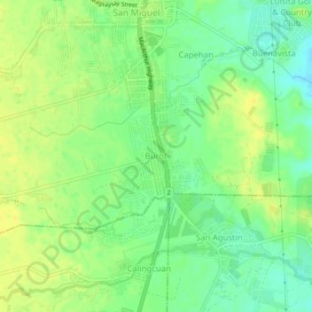
Name: Burot topographic map, elevation, terrain.

Location: Burot, Tarlac City, Tarlac, Central Luzon, 2301, Philippines (15.39399 120.58018 15.43399 120.62018)

Average elevation: 55 m

Minimum elevation: 43 m

Maximum elevation: 64 m

Other topographic maps

Click on a map to view its topography, its elevation and its terrain.

Maria Cristina Park

Philippines > Tarlac > Tarlac City

Average elevation: 48 m

San Rafael Creek

Philippines > Tarlac > Tarlac City

Average elevation: 41 m

Gear up for your next adventure:

🎒Fully Waterproof Backpack - Total protection for photography gear and electronics
🧥Insulated Jacket - Keep warm in cold outdoor conditions
🧢Hiking Sun Hat - Wide-brimmed protection for exposed mountain ridges
Lightweight Backpacking Tent - Compact tent for efficient hiking trips
🥾Waterproof Hiking Shoes - Durable shoes for wet and rugged trails

As an Amazon Associate, this site earns from qualifying purchases at no extra cost to you.