Geolocate

Daraitan topographic map

Click on the map to display elevation.

About this map

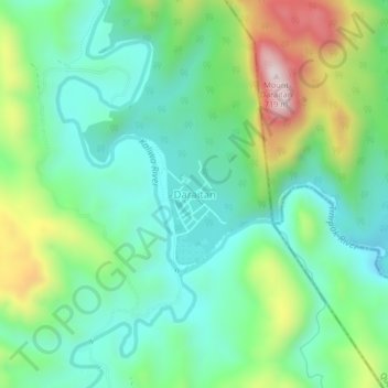
Name: Daraitan topographic map, elevation, terrain.

Location: Daraitan, Tanay, Rizal, Calabarzon, Philippines (14.58397 121.40929 14.62397 121.44929)

Average elevation: 291 m

Minimum elevation: 120 m

Maximum elevation: 685 m

Other topographic maps

Click on a map to view its topography, its elevation and its terrain.

Tanay River

Philippines > Rizal > Tanay > Little Ville

Average elevation: 34 m

Gear up for your next adventure:

🧣Merino Neck Gaiter - Protects against wind, sun, and cold at high altitudes
Lightweight Backpacking Tent - Compact tent for efficient hiking trips
🥾All-Terrain Hiking Boots - Versatile boots for varied hiking conditions
🥾Mountain Hiking Boots - High-traction boots for rocky terrain
🧼Travel Hand Sanitizer - Keep hands clean when water is scarce

As an Amazon Associate, this site earns from qualifying purchases at no extra cost to you.