Geolocate

Quartzite topographic map

Click on the map to display elevation.

About this map

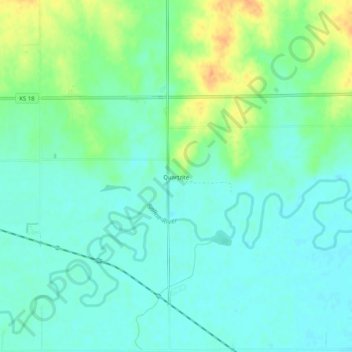
Name: Quartzite topographic map, elevation, terrain.

Location: Quartzite, Lincoln County, Kansas, United States (39.00112 -98.11477 39.04112 -98.07477)

Average elevation: 418 m

Minimum elevation: 406 m

Maximum elevation: 445 m

Gear up for your next adventure:

🥾Mountain Hiking Boots - High-traction boots for rocky terrain
🧤Rechargeable Heated Gloves - Extreme warmth for Canadian winter expeditions
🎒Fully Waterproof Backpack - Total protection for photography gear and electronics
🥾Trekking Poles - Adjustable trekking poles to reduce knee stress and improve stability
🧦Hiking Liner Socks - Thin base layer to prevent friction and blisters

As an Amazon Associate, this site earns from qualifying purchases at no extra cost to you.