Geolocate

Palmyra topographic map

Click on the map to display elevation.

About this map

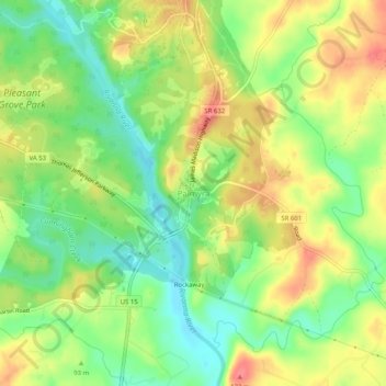
Name: Palmyra topographic map, elevation, terrain.

Location: Palmyra, Fluvanna County, Virginia, United States (37.84097 -78.28334 37.88097 -78.24334)

Average elevation: 98 m

Minimum elevation: 64 m

Maximum elevation: 135 m

Other topographic maps

Click on a map to view its topography, its elevation and its terrain.

Columbia

United States > Virginia > Fluvanna County

Average elevation: 78 m

Gear up for your next adventure:

🥾Light Hiking Boots - Lightweight and comfortable boots for day hikes
🧥Thermal Layer - Insulating layer for cold outdoor conditions
Lightweight Backpacking Tent - Compact tent for efficient hiking trips
🧢Sun Protection Cap - Breathable cap to protect from sun exposure
💧Hydration Bladder - Hands-free hydration solution for long treks

As an Amazon Associate, this site earns from qualifying purchases at no extra cost to you.