Geolocate

Haigang topographic map

Click on the map to display elevation.

About this map

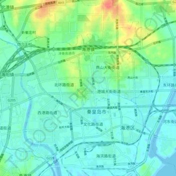
Name: Haigang topographic map, elevation, terrain.

Location: Haigang, Haigang District, Qinhuangdao, Hebei, China (39.92697 119.55309 39.97048 119.64471)

Average elevation: 12 m

Minimum elevation: -7 m

Maximum elevation: 50 m

Other topographic maps

Click on a map to view its topography, its elevation and its terrain.

Yang River

China > Hebei > Qinhuangdao

Average elevation: 99 m

Gear up for your next adventure:

🥾Mountain Hiking Shoes - Shoes with superior grip for mountainous terrain
💧Hydration Pack - Hands-free hydration system for long hikes
🛌Down Sleeping Bag - Superior warmth-to-weight ratio for cold nights
🌡️Emergency Mylar Blankets - Compact thermal protection for unexpected nights outdoors
🔦LED Headlamp - Hands-free lighting for early morning starts or late finishes

As an Amazon Associate, this site earns from qualifying purchases at no extra cost to you.