Geolocate

Hethersett topographic map

Click on the map to display elevation.

About this map

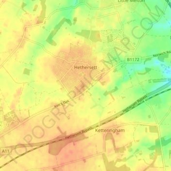
Name: Hethersett topographic map, elevation, terrain.

Location: Hethersett, South Norfolk, Norfolk, England, United Kingdom (52.58041 1.15382 52.60973 1.22418)

Average elevation: 44 m

Minimum elevation: 19 m

Maximum elevation: 57 m

Gear up for your next adventure:

🥾Trail Hiking Socks - Comfortable socks to prevent blisters and fatigue
🥾Trail Running Boots - Durable shoes designed for trail running
🔋Solar Power Bank - Keep your GPS and devices charged during long outdoor trips
🦟Insect Repellent - Keep mosquitoes and black flies away in wooded areas
💡Portable Camping Lamp - Rechargeable lamp for campsite lighting

As an Amazon Associate, this site earns from qualifying purchases at no extra cost to you.