Geolocate

Niagra topographic map

Click on the map to display elevation.

About this map

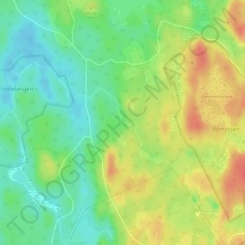
Name: Niagra topographic map, elevation, terrain.

Location: Niagra, Karlskoga kommun, Örebro County, Sweden (59.26547 14.63282 59.26557 14.63292)

Average elevation: 151 m

Minimum elevation: 128 m

Maximum elevation: 177 m

Gear up for your next adventure:

🧥Packable Rain Jacket - Breathable waterproof layer for unpredictable weather
Lightweight Backpacking Tent - Compact tent for efficient hiking trips
🐕Hiking Dog Pack - Let your canine companion carry their own water and food
🧥Waterproof Jacket - Lightweight rain jackets for hiking and outdoor activities
🧼Biodegradable Camp Soap - Environmentally friendly cleaning for gear and body

As an Amazon Associate, this site earns from qualifying purchases at no extra cost to you.