Geolocate

Bolpur topographic map

Click on the map to display elevation.

About this map

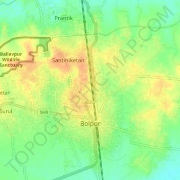
Name: Bolpur topographic map, elevation, terrain.

Location: Bolpur, Bolpur Sriniketan, Birbhum, West Bengal, India (23.64183 87.66387 23.70303 87.70963)

Average elevation: 50 m

Minimum elevation: 33 m

Maximum elevation: 69 m

Gear up for your next adventure:

🧶550 Survival Paracord - Versatile utility cord for emergency repairs and rigging
🧦Hiking Socks - Moisture-wicking and comfortable socks for long hikes
Tent Footprint - Protect tent floor and increase durability
🦶Anti-Blister Balm - Prevents friction and hotspots during long ascents
🦌Outdoor Trail Camera - Monitor wildlife activity near your favorite spots

As an Amazon Associate, this site earns from qualifying purchases at no extra cost to you.