
Malard topographic map
Interactive map
Click on the map to display elevation.
About this map
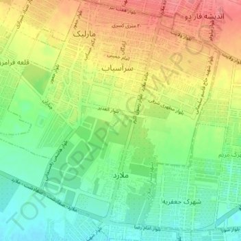
Name: Malard topographic map, elevation, terrain.
Location: Malard, بخش مرکزی ملارد, شهرستان ملارد, Téhéran, Iran (35.65214 50.94503 35.70512 51.00582)
Average elevation: 1,176 m
Minimum elevation: 1,147 m
Maximum elevation: 1,213 m