Geolocate

Swargarohini topographic map

Click on the map to display elevation.

About this map

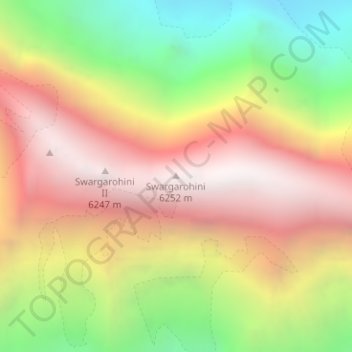
Name: Swargarohini topographic map, elevation, terrain.

Location: Swargarohini, Mori, Uttarkashi District, Uttarakhand, India (31.10031 78.51218 31.10041 78.51228)

Average elevation: 5,310 m

Minimum elevation: 4,287 m

Maximum elevation: 6,200 m

Gear up for your next adventure:

🧭GPS Outdoor Watch - Smart watch for navigation and fitness tracking in nature
Camping Groundsheet - Protect your tent from moisture and dirt
🧶550 Survival Paracord - Versatile utility cord for emergency repairs and rigging
🧢Hiking Hat - Sun-protective and breathable hats for long treks
🧦Merino Wool Socks - Moisture-wicking comfort for long-distance hiking

As an Amazon Associate, this site earns from qualifying purchases at no extra cost to you.