Geolocate

Zovuni topographic map

Click on the map to display elevation.

About this map

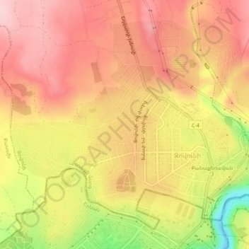
Name: Zovuni topographic map, elevation, terrain.

Location: Zovuni, Yeghvard region, Kotayk Province, Armenia (40.22579 44.47813 40.25193 44.51889)

Average elevation: 1,194 m

Minimum elevation: 1,060 m

Maximum elevation: 1,268 m

Gear up for your next adventure:

🛶Canoe Life Vest - Safety vest for water sports
🔦LED Headlamp - Hands-free lighting for early morning starts or late finishes
🧦Merino Wool Socks - Moisture-wicking comfort for long-distance hiking
👟Trail Running Shoes - Agile footwear for fast-paced topographic exploration
🎒Hiking Daypack - Lightweight and durable backpacks for day trips and excursions

As an Amazon Associate, this site earns from qualifying purchases at no extra cost to you.