Geolocate

Alva topographic map

Click on the map to display elevation.

About this map

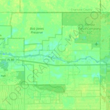
Name: Alva topographic map, elevation, terrain.

Location: Alva, Lee County, Florida, 33920, United States (26.68641 -81.70709 26.75483 -81.56626)

Average elevation: 7 m

Minimum elevation: -1 m

Maximum elevation: 14 m

Gear up for your next adventure:

🌡️Emergency Mylar Blankets - Compact thermal protection for unexpected nights outdoors
🔨Vehicle Emergency Tool - Safety tool for remote road trips to trailheads
🧢Hiking Hat - Sun-protective and breathable hats for long treks
🧴Sunscreen SPF - Broad-spectrum sunscreen for outdoor activities
🧢Outdoor Cap - Protective cap for sun and rain during hikes

As an Amazon Associate, this site earns from qualifying purchases at no extra cost to you.