
Thank you for supporting this site ❤️
Make a donation
Make a donation
Gear up for your next adventure:
As an Amazon Associate, this site earns from qualifying purchases at no extra cost to you.
Hamipré topographic map
Click on the map to display elevation.
Thank you for supporting this site ❤️
Make a donation
Make a donation
Gear up for your next adventure:
As an Amazon Associate, this site earns from qualifying purchases at no extra cost to you.
About this map
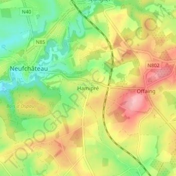
Name: Hamipré topographic map, elevation, terrain.
Location: Hamipré, Hamipre, Neufchâteau, Luxemburg, Wallonië, 6840, België (49.81596 5.43645 49.85596 5.47645)
Average elevation: 446 m
Minimum elevation: 383 m
Maximum elevation: 518 m
Thank you for supporting this site ❤️
Make a donation
Make a donation
Gear up for your next adventure:
As an Amazon Associate, this site earns from qualifying purchases at no extra cost to you.