Geolocate

Rainier topographic map

Click on the map to display elevation.

About this map
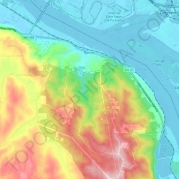
Name: Rainier topographic map, elevation, terrain.

Location: Rainier, Columbia County, Oregon, United States (46.04008 -122.98031 46.10909 -122.90297)

Average elevation: 123 m

Minimum elevation: -5 m

Maximum elevation: 358 m

Other topographic maps

Click on a map to view its topography, its elevation and its terrain.

Yankton

United States > Oregon > Columbia County

Average elevation: 111 m

Camp Wilkerson

United States > Oregon > Columbia County

Average elevation: 391 m

Deer Island

United States > Oregon > Columbia County

Average elevation: 46 m

Inglis

United States > Oregon > Columbia County

Average elevation: 76 m

Gear up for your next adventure:

💧Collapsible Water Bottle - Space-saving water bottle for outdoor activities
🧊Portable Cooler - Keep food and drinks cold during outdoor adventures
🥫Freeze-Dried Meals - Lightweight, high-calorie nutrition for multi-day treks
🧢Hiking Hat - Sun-protective and breathable hats for long treks
🧊Insulated Water Bottle - Keeps drinks cold in summer and prevents freezing in winter

As an Amazon Associate, this site earns from qualifying purchases at no extra cost to you.