Geolocate

Pelechua topographic map

Click on the map to display elevation.

About this map

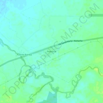
Name: Pelechua topographic map, elevation, terrain.

Location: Pelechua, Riohacha, La Guajira, RAP Caribe, Colombia (11.24446 -73.16663 11.28446 -73.12663)

Average elevation: 16 m

Minimum elevation: 11 m

Maximum elevation: 24 m

Other topographic maps

Click on a map to view its topography, its elevation and its terrain.

Laguna Salada

Colombia > La Guajira > Riohacha

Average elevation: 6 m

Río Ranchería

Colombia > La Guajira > Riohacha

Average elevation: 3 m

Gear up for your next adventure:

🦯Trekking Poles - Reduced impact on joints for steep topographic climbs
🧦Outdoor Socks - Durable socks designed for hiking and outdoor sports
🏕️Camping Hammock - Integrated protection for sleeping between trees
Bushcraft Tarp - Versatile emergency shelter or gear protection
🛶Kayak Accessories - Essential gear for safe and fun kayaking adventures

As an Amazon Associate, this site earns from qualifying purchases at no extra cost to you.