
Thank you for supporting this site ❤️
Make a donation
Make a donation
Gear up for your next adventure:
As an Amazon Associate, this site earns from qualifying purchases at no extra cost to you.
Bulachauri topographic map
Click on the map to display elevation.
Thank you for supporting this site ❤️
Make a donation
Make a donation
Gear up for your next adventure:
As an Amazon Associate, this site earns from qualifying purchases at no extra cost to you.
About this map
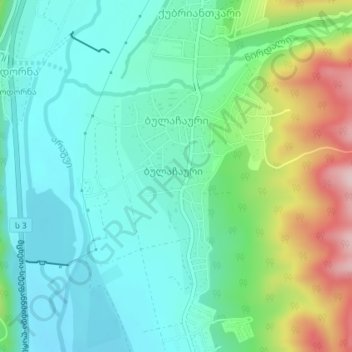
Name: Bulachauri topographic map, elevation, terrain.
Location: Bulachauri, Dusheti Municipality, Mtskheta-Mtianeti, Georgia (42.03969 44.75565 42.05790 44.77137)
Average elevation: 696 m
Minimum elevation: 620 m
Maximum elevation: 897 m
Thank you for supporting this site ❤️
Make a donation
Make a donation
Gear up for your next adventure:
As an Amazon Associate, this site earns from qualifying purchases at no extra cost to you.