

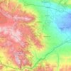
Beylagan District topographic map
Click on the map to display elevation.
Beylagan District
Beylagan is one of the southwestern districts of Azerbaijan and situated in the Mil valley of the Kur – Araz lowland and in the middle of the Kur and Araz rivers. Geographical coordinates are 39°45’ North latitude and 47°30’ West longitude and bordering Agchabadi, Zardab, Imishli, Fuzuli districts and Iran Islamic Republic in the south-east. Some parts of the Harami plain belong to the district and the northeast part is below the ocean level. More than 40% of the territory is 0 – 100 meters, 25% is 100 – 200 meters and 35% is below 0 meters. Absolute altitude changes between 200 – 250 meters towards Harami plain. Generally, Beylagan is considered a seismic active zone.
About this map

Name: Beylagan District topographic map, elevation, terrain.
Location: Beylagan District, 1200, Azerbaijan (39.57202 47.44025 40.14155 47.94868)
Average elevation: 58 m
Minimum elevation: -11 m
Maximum elevation: 338 m
Other topographic maps
Click on a map to view its topography, its elevation and its terrain.

Gadabay
Gadabay lies at the northern foot of the Shahdagh Range, at an altitude of 1460 meters, on the coast of the Mis River. The city is located in the middle and high mountainous areas of the Lesser Caucasus (also called Little Caucasus).
Average elevation: 1,499 m


Gazakh
Gazakh region is located in the western part of the republic, in the western part of the vast Ganja-Gazakh plain, which starts from the slopes of the mountain range of the Lesser Caucasus and extends along the right bank of the Kura river. The highest elevation is "Odun" mountain (1316 meters). Its nature is…
Average elevation: 382 m


Shirvan
Throughout its history, Shirvan has suffered from floods because of its proximity to the river and the relatively low elevation of most of the town.
Average elevation: 16 m


