
Lakewood topographic map
Click on the map to display elevation.
Lakewood
Lakewood is located at 39°42′17″N 105°04′53″W / 39.70472°N 105.08139°W / 39.70472; -105.08139 at an elevation of 5,518 feet (1,682 m). Located at the junction of U.S. Route 6 and Colorado State Highway 121 in central Colorado, the city lies immediately west of Denver and 62 miles (100 km) north-northwest of Colorado Springs.
About this map
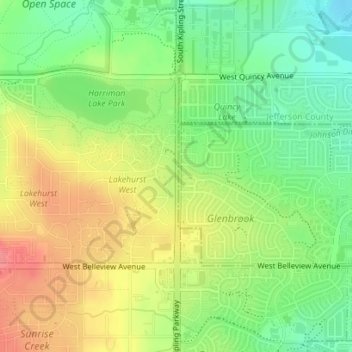
Name: Lakewood topographic map, elevation, terrain.
Location: Lakewood, Jefferson County, Colorado, United States (39.62697 -105.11032 39.63519 -105.10987)
Average elevation: 1,717 m
Minimum elevation: 1,681 m
Maximum elevation: 1,758 m
Other topographic maps
Click on a map to view its topography, its elevation and its terrain.