Geolocate

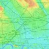
Hackney Marshes topographic map

Click on the map to display elevation.

About this map

Name: Hackney Marshes topographic map, elevation, terrain.

Location: Hackney Marshes, Homerton, London Borough of Hackney, London, Greater London, England, United Kingdom (51.55159 -0.03913 51.56137 -0.01804)

Average elevation: 10 m

Minimum elevation: 3 m

Maximum elevation: 23 m

Other topographic maps

Click on a map to view its topography, its elevation and its terrain.
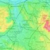
London

United Kingdom > England > London

Average elevation: 77 m

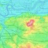
Stratford

United Kingdom > England > London

Average elevation: 11 m

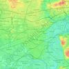
Islington

United Kingdom > England > London

Average elevation: 30 m

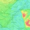
London

United Kingdom > England > London

Average elevation: 42 m

Tooting

United Kingdom > England > London

Average elevation: 30 m

London

United Kingdom > England > London

Average elevation: 21 m

Twickenham

United Kingdom > England > London

Average elevation: 18 m

One Tree Close

United Kingdom > England > London

Average elevation: 43 m

Gould's Green

United Kingdom > England > London

Average elevation: 38 m

Erith

United Kingdom > England > London

Average elevation: 17 m

Gear up for your next adventure:

🥾Trail Hiking Socks - Comfortable socks to prevent blisters and fatigue
🔦UV Flashlight - Detect minerals or specific insects in the dark
🧦Hiking Socks - Moisture-wicking and comfortable socks for long hikes
🥾Lightweight Hiking Shoes - Comfortable shoes for day hikes
🦶Hiking Shoe Insoles - Added support for high arches and long days on feet

As an Amazon Associate, this site earns from qualifying purchases at no extra cost to you.