
Thank you for supporting this site ❤️
Make a donation
Make a donation
Gear up for your next adventure:
As an Amazon Associate, this site earns from qualifying purchases at no extra cost to you.
Bangsil topographic map
Click on the map to display elevation.
Thank you for supporting this site ❤️
Make a donation
Make a donation
Gear up for your next adventure:
As an Amazon Associate, this site earns from qualifying purchases at no extra cost to you.
About this map
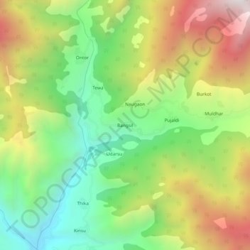
Name: Bangsil topographic map, elevation, terrain.
Location: Bangsil, Dhanaulti, Tehri Garhwal, Uttarakhand, India (30.52635 78.16335 30.56635 78.20335)
Average elevation: 1,871 m
Minimum elevation: 1,294 m
Maximum elevation: 2,654 m
Thank you for supporting this site ❤️
Make a donation
Make a donation
Gear up for your next adventure:
As an Amazon Associate, this site earns from qualifying purchases at no extra cost to you.