Geolocate

Maicao topographic map

Click on the map to display elevation.

About this map

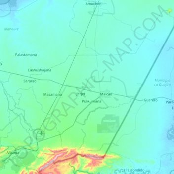
Name: Maicao topographic map, elevation, terrain.

Location: Maicao, La Guajira, RAP Caribe, Colombia (11.11528 -72.64828 11.69448 -71.97808)

Average elevation: 68 m

Minimum elevation: -4 m

Maximum elevation: 862 m

Other topographic maps

Click on a map to view its topography, its elevation and its terrain.

Guajira

Colombia > La Guajira > La Jagua del Pilar

Average elevation: 2,379 m

Gear up for your next adventure:

🧦Hiking Socks - Moisture-wicking and comfortable socks for long hikes
🥾Waterproof Trail Shoes - Shoes designed to handle wet terrain
🎒Backpack Rain Cover - External shield to keep your entire pack dry
🧢Sun Protection Cap - Breathable cap to protect from sun exposure
🐕Hiking Dog Pack - Let your canine companion carry their own water and food

As an Amazon Associate, this site earns from qualifying purchases at no extra cost to you.