Geolocate

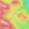
Mont Louis topographic map

Click on the map to display elevation.

About this map

Name: Mont Louis topographic map, elevation, terrain.

Location: Mont Louis, Saint-Maxime-du-Mont-Louis, La Haute-Gaspésie, Gaspésie–Îles-de-la-Madeleine, Québec, G0E 1T0, Canada (49.21907 -65.69728 49.21917 -65.69718)

Average elevation: 307 m

Minimum elevation: 13 m

Maximum elevation: 481 m

Other topographic maps

Click on a map to view its topography, its elevation and its terrain.
Gear up for your next adventure:

🔋Lithium AA Batteries - Long-lasting power that performs in extreme cold
🧣Evaporative Cooling Towel - Beat the heat during intense summer climbs
🥾Mountain Hiking Boots - High-traction boots for rocky terrain
🥾Hiking Leggings - Comfortable leggings for outdoor activities
🧭GPS Handheld Device - Reliable GPS navigation for outdoor adventures

As an Amazon Associate, this site earns from qualifying purchases at no extra cost to you.