Geolocate

Oschersleben topographic map

Click on the map to display elevation.

About this map

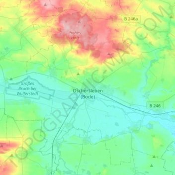
Name: Oschersleben topographic map, elevation, terrain.

Location: Oschersleben, Börde, Saxony-Anhalt, 39387, Germany (51.95572 11.12857 52.10909 11.40960)

Average elevation: 112 m

Minimum elevation: 72 m

Maximum elevation: 218 m

Gear up for your next adventure:

🧤Thermal Hiking Gloves - Grip-enhanced gloves for cold-weather altitude trekking
🛌Down Sleeping Bag - Superior warmth-to-weight ratio for cold nights
🥾Waterproof Hiking Shoes - Durable shoes for wet and rugged trails
🧰Emergency Multi-Tool - Compact multi-tool for outdoor survival
Camping Groundsheet - Protect your tent from moisture and dirt

As an Amazon Associate, this site earns from qualifying purchases at no extra cost to you.