Geolocate

Bad Endbach topographic map

Click on the map to display elevation.

About this map
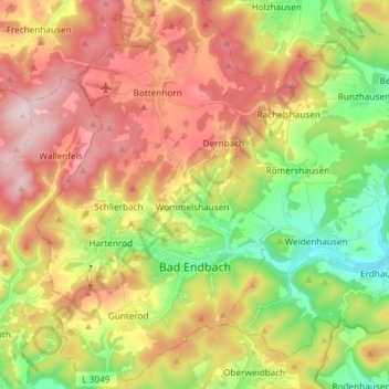
Name: Bad Endbach topographic map, elevation, terrain.

Location: Bad Endbach, Landkreis Marburg-Biedenkopf, Hessen, 35080, Duitsland (50.72216 8.43385 50.81570 8.52500)

Average elevation: 414 m

Minimum elevation: 236 m

Maximum elevation: 607 m

Other topographic maps

Click on a map to view its topography, its elevation and its terrain.

Gear up for your next adventure:

🪜Heavy Duty Carabiners - Multi-use clips for securing gear to your backpack
🪑Ultralight Camping Stool - Compact seating for rest stops during long hikes
🐕Hiking Dog Pack - Let your canine companion carry their own water and food
🚲Bike Repair Kit - Essential tools for on-trail mechanical issues
🛏️Camping Sleeping Mat - Comfortable mats for sleeping outdoors

As an Amazon Associate, this site earns from qualifying purchases at no extra cost to you.