Geolocate

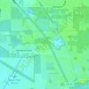
Perry topographic map

Click on the map to display elevation.

About this map

Name: Perry topographic map, elevation, terrain.

Location: Perry, Taylor County, Florida, United States (30.08411 -83.60481 30.13580 -83.55423)

Average elevation: 16 m

Minimum elevation: 9 m

Maximum elevation: 21 m

Other topographic maps

Click on a map to view its topography, its elevation and its terrain.
Keaton Beach

United States > Florida > Taylor County

Average elevation: 3 m

Covington

United States > Florida > Taylor County

Average elevation: 12 m

Steinhatchee

United States > Florida > Taylor County

Average elevation: 6 m

Bonita Beach

United States > Florida > Taylor County

Average elevation: 2 m

Fish Creek

United States > Florida > Taylor County

Average elevation: 3 m

Eridu

United States > Florida > Taylor County

Average elevation: 19 m

Keaton Beach

United States > Florida > Taylor County

Average elevation: 3 m

channel

United States > Florida > Taylor County > Keaton Beach

Average elevation: 0 m

Gear up for your next adventure:

🧥Thermal Layer - Insulating layer for cold outdoor conditions
🧦Hiking Socks - Moisture-wicking and comfortable socks for long hikes
⛺Tent Footprint - Protect tent floor and increase durability
🧥Softshell Hiking Jacket - The perfect balance of wind protection and breathability
🧴Insect Repellent - Protect yourself from bugs during outdoor adventures

As an Amazon Associate, this site earns from qualifying purchases at no extra cost to you.