

Cochem topographic map
Click on the map to display elevation.
Cochem
Cochem lies at an elevation of some 83 m above sea level and the municipal area measures 21.2 km2. The town centre with the outlying centre of Sehl upstream lies on the Moselle's left bank, while the constituent centre of Cond lies on its right. A further constituent centre, Brauheck, with its commercial area, air force barracks and new town development, lies in the heights of the Eifel on Bundesstraße 259, some 2 km (1 mi) from the town centre. Emptying into the Moselle in Cochem are the Kraklebach, the Ebernacher Bach, the Sehlerbach, the Falzbach, the Märtscheltbach and the Enthetbach.
About this map
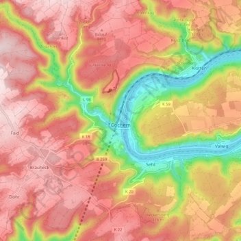
Name: Cochem topographic map, elevation, terrain.
Location: Cochem, Landkreis Cochem-Zell, Rhineland-Palatinate, Germany (50.11968 7.10805 50.17937 7.21255)
Average elevation: 286 m
Minimum elevation: 78 m
Maximum elevation: 419 m