
Thank you for supporting this site ❤️
Make a donation
Make a donation
Gear up for your next adventure:
As an Amazon Associate, this site earns from qualifying purchases at no extra cost to you.
Mağaraköy topographic map
Click on the map to display elevation.
Thank you for supporting this site ❤️
Make a donation
Make a donation
Gear up for your next adventure:
As an Amazon Associate, this site earns from qualifying purchases at no extra cost to you.
About this map
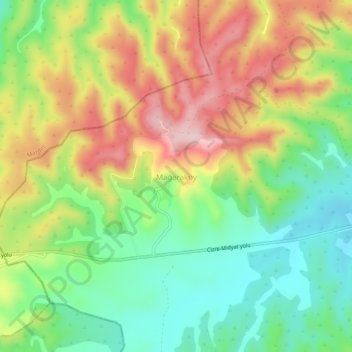
Name: Mağaraköy topographic map, elevation, terrain.
Location: Mağaraköy, İdil, Şırnak, Güneydoğu Anadolu Bölgesi, Turkije (37.26271 41.55144 37.30271 41.59144)
Average elevation: 973 m
Minimum elevation: 869 m
Maximum elevation: 1,107 m
Thank you for supporting this site ❤️
Make a donation
Make a donation
Gear up for your next adventure:
As an Amazon Associate, this site earns from qualifying purchases at no extra cost to you.