Geolocate

O Río Vello topographic map

Click on the map to display elevation.

About this map

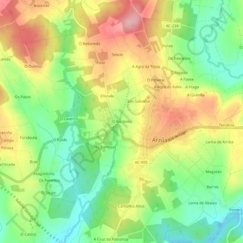
Name: O Río Vello topographic map, elevation, terrain.

Location: O Río Vello, Arzúa, A Coruña, Galicia, 15810, Spain (42.91102 -8.18911 42.95102 -8.14911)

Average elevation: 359 m

Minimum elevation: 289 m

Maximum elevation: 441 m

Gear up for your next adventure:

🧼Biodegradable Camp Soap - Environmentally friendly cleaning for gear and body
🧦Outdoor Socks - Durable socks designed for hiking and outdoor sports
🧣Evaporative Cooling Towel - Beat the heat during intense summer climbs
🧢Outdoor Cap - Protective cap for sun and rain during hikes
👖Convertible Hiking Pants - Zip-off legs to adapt to changing weather conditions

As an Amazon Associate, this site earns from qualifying purchases at no extra cost to you.