Geolocate

Siguis topographic map

Click on the map to display elevation.

About this map

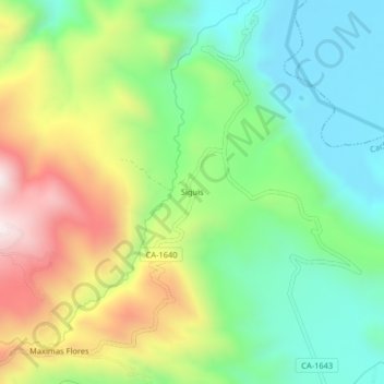
Name: Siguis topographic map, elevation, terrain.

Location: Siguis, Cachachi, Cajabamba, Cajamarca, Perú (-7.58545 -78.19720 -7.54545 -78.15720)

Average elevation: 2,308 m

Minimum elevation: 2,049 m

Maximum elevation: 2,745 m

Gear up for your next adventure:

🔭Outdoor Binoculars - Lightweight binoculars for birdwatching and hiking
🦶Anti-Blister Balm - Prevents friction and hotspots during long ascents
🧥Waterproof Pants - Keep dry during rainy hiking conditions
🧥Ultralight Puffy Jacket - Maximum warmth that packs down to the size of an orange
🎒Hiking Backpack - Lightweight and ergonomic backpacks for day hikes or multi-day treks

As an Amazon Associate, this site earns from qualifying purchases at no extra cost to you.