
Hollow topographic map
Click on the map to display elevation.
About this map
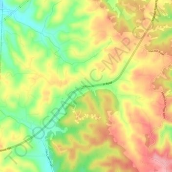
Name: Hollow topographic map, elevation, terrain.
Average elevation: 221 m
Minimum elevation: 160 m
Maximum elevation: 273 m
Other topographic maps
Click on a map to view its topography, its elevation and its terrain.
Dr. Edmund A. Babler Memorial State Park
United States > Missouri > Saint Louis County > Wildwood
Average elevation: 187 m
Dr. Edmund A. Babler Memorial State Park
United States > Missouri > Saint Louis County > Wildwood
Average elevation: 187 m