
Thank you for supporting this site ❤️
Make a donation
Make a donation
Gear up for your next adventure:
As an Amazon Associate, this site earns from qualifying purchases at no extra cost to you.
Rakhundi Top topographic map
Click on the map to display elevation.
Thank you for supporting this site ❤️
Make a donation
Make a donation
Gear up for your next adventure:
As an Amazon Associate, this site earns from qualifying purchases at no extra cost to you.
About this map
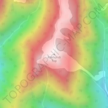
Name: Rakhundi Top topographic map, elevation, terrain.
Location: Rakhundi Top, Banjar, Kullu, Himachal Pradesh, India (31.70073 77.49189 31.70083 77.49199)
Average elevation: 3,095 m
Minimum elevation: 2,530 m
Maximum elevation: 3,610 m
Thank you for supporting this site ❤️
Make a donation
Make a donation
Gear up for your next adventure:
As an Amazon Associate, this site earns from qualifying purchases at no extra cost to you.