
Thank you for supporting this site ❤️
Make a donation
Make a donation
Gear up for your next adventure:
As an Amazon Associate, this site earns from qualifying purchases at no extra cost to you.
Sar topographic map
Click on the map to display elevation.
Thank you for supporting this site ❤️
Make a donation
Make a donation
Gear up for your next adventure:
As an Amazon Associate, this site earns from qualifying purchases at no extra cost to you.
About this map
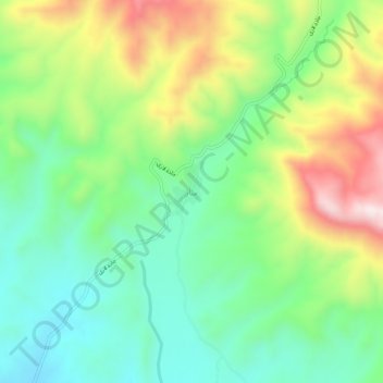
Name: Sar topographic map, elevation, terrain.
Location: Sar, دهستان رودقات, بخش صوفیان, Shabestar County, Iran (38.31264 46.17370 38.35264 46.21370)
Average elevation: 1,697 m
Minimum elevation: 1,514 m
Maximum elevation: 2,018 m
Thank you for supporting this site ❤️
Make a donation
Make a donation
Gear up for your next adventure:
As an Amazon Associate, this site earns from qualifying purchases at no extra cost to you.