Geolocate

Vilameán topographic map

Click on the map to display elevation.

About this map

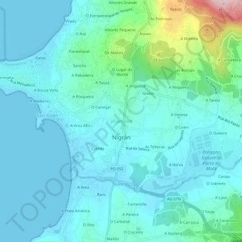
Name: Vilameán topographic map, elevation, terrain.

Location: Vilameán, Nigrán, Vigo, Pontevedra, Galicia, 36350, España (42.12321 -8.82709 42.16321 -8.78709)

Average elevation: 54 m

Minimum elevation: 0 m

Maximum elevation: 346 m

Other topographic maps

Click on a map to view its topography, its elevation and its terrain.

Priegue

España > Galicia > Vigo > Nigrán

Average elevation: 135 m

Chandebrito

España > Galicia > Vigo > Nigrán

Average elevation: 250 m

Gear up for your next adventure:

🛶Kayak Dry Bag - Waterproof storage for kayaking adventures
🥾Waterproof Trail Shoes - Shoes designed to handle wet terrain
🧭GPS Tracker - Track your location in remote areas safely
🥾Mountain Trail Shoes - High-traction shoes for mountain trails
🧦Hiking Socks - Moisture-wicking and comfortable socks for long hikes

As an Amazon Associate, this site earns from qualifying purchases at no extra cost to you.