Geolocate

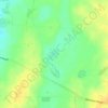
Warooka topographic map

Click on the map to display elevation.

About this map

Name: Warooka topographic map, elevation, terrain.

Location: Warooka, Yorke Peninsula Council, South Australia, 5577, Australia (-35.12780 137.12770 -34.92431 137.52731)

Average elevation: 19 m

Minimum elevation: -1 m

Maximum elevation: 106 m

Other topographic maps

Click on a map to view its topography, its elevation and its terrain.
Gear up for your next adventure:

💡Solar Camping Lamp - Eco-friendly lighting for campsites
🥾Trekking Poles - Adjustable trekking poles to reduce knee stress and improve stability
🧥Fleece Jacket - Warm and lightweight jacket for layering
🧤Thermal Hiking Gloves - Grip-enhanced gloves for cold-weather altitude trekking
🏃Hydration Running Vest - Carry water and maps close to your body for speed

As an Amazon Associate, this site earns from qualifying purchases at no extra cost to you.