
Thank you for supporting this site ❤️
Make a donation
Make a donation
Gear up for your next adventure:
As an Amazon Associate, this site earns from qualifying purchases at no extra cost to you.
Laflèche topographic map
Click on the map to display elevation.
Thank you for supporting this site ❤️
Make a donation
Make a donation
Gear up for your next adventure:
As an Amazon Associate, this site earns from qualifying purchases at no extra cost to you.
About this map
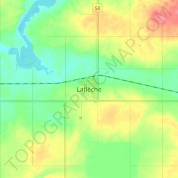
Name: Laflèche topographic map, elevation, terrain.
Location: Laflèche, Saskatchewan, S0H 2K0, Canada (49.66363 -106.61474 49.74363 -106.53474)
Average elevation: 740 m
Minimum elevation: 713 m
Maximum elevation: 786 m
Thank you for supporting this site ❤️
Make a donation
Make a donation
Gear up for your next adventure:
As an Amazon Associate, this site earns from qualifying purchases at no extra cost to you.