Geolocate

Beachlands topographic map

Click on the map to display elevation.

About this map

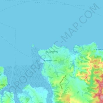
Name: Beachlands topographic map, elevation, terrain.

Location: Beachlands, Franklin, Auckland, 2018, New Zealand (-36.92236 174.95715 -36.84236 175.03715)

Average elevation: 18 m

Minimum elevation: -1 m

Maximum elevation: 184 m

Gear up for your next adventure:

🧤Rechargeable Heated Gloves - Extreme warmth for Canadian winter expeditions
🛌Insulated Sleeping Pad - Critical thermal barrier between you and the cold ground
Lightweight Backpacking Tent - Compact tent for efficient hiking trips
🏕️Camping Hammock - Integrated protection for sleeping between trees
🔦LED Flashlight - Powerful and long-lasting flashlight for camping and emergencies

As an Amazon Associate, this site earns from qualifying purchases at no extra cost to you.