
Friant topographic map
Click on the map to display elevation.
Friant
Friant (formerly, Converse Ferry, Jones Ferry, Hamptonville, and Pollasky) is a census-designated place (CDP) in Fresno County, California, United States. The population was 549 at the 2010 census, down from 778 at the 2000 census. Friant is located 11.5 miles (19 km) north of Clovis, at an elevation of 344 feet (105 m).
About this map
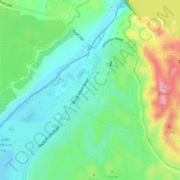
Name: Friant topographic map, elevation, terrain.
Location: Friant, Fresno County, California, 93626, United States (36.96774 -119.73163 37.00023 -119.69248)
Average elevation: 135 m
Minimum elevation: 91 m
Maximum elevation: 226 m