Geolocate

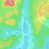
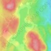
Lac Lise topographic map

Click on the map to display elevation.

About this map

Name: Lac Lise topographic map, elevation, terrain.

Location: Lac Lise, Chertsey, Matawinie, Lanaudière, Québec, Canada (46.07897 -73.85384 46.08074 -73.85167)

Average elevation: 242 m

Minimum elevation: 166 m

Maximum elevation: 332 m

Other topographic maps

Click on a map to view its topography, its elevation and its terrain.
Lac Lafond

Canada > Québec > Matawinie > Chertsey

Average elevation: 341 m

Lac-David

Canada > Québec > Matawinie > Chertsey

Average elevation: 368 m

Lac Grenier

Canada > Québec > Matawinie > Chertsey

Average elevation: 343 m

Lac Beaulne

Canada > Québec > Matawinie > Chertsey

Average elevation: 365 m

9e Lac

Canada > Québec > Matawinie > Chertsey

Average elevation: 315 m

Lac Taillefer

Canada > Québec > Matawinie > Chertsey

Average elevation: 313 m

Rivière Jean-Venne

Canada > Québec > Matawinie > Chertsey

Average elevation: 359 m

Mont Tête-Dure

Canada > Québec > Matawinie > Chertsey

Average elevation: 521 m

Gear up for your next adventure:

🦯Trekking Poles - Reduced impact on joints for steep topographic climbs
❄️Traction Ice Cleats - Slip-on spikes for icy trails and winter hiking
🧤Rechargeable Heated Gloves - Extreme warmth for Canadian winter expeditions
💧Filtered Water Bottle - Safe drinking water on the go
🥾Hiking Gaiters - Protect legs and shoes from mud, snow, and debris

As an Amazon Associate, this site earns from qualifying purchases at no extra cost to you.