Geolocate

Habagatan topographic map

Click on the map to display elevation.

About this map
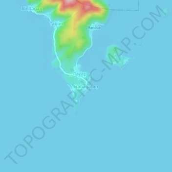
Name: Habagatan topographic map, elevation, terrain.

Location: Habagatan, Binangonan, Rizal, Calabarzon, 1940, Philippines (14.27388 121.21924 14.31388 121.25924)

Average elevation: 10 m

Minimum elevation: -3 m

Maximum elevation: 206 m

Other topographic maps

Click on a map to view its topography, its elevation and its terrain.

Calumpang

Philippines > Rizal > Binangonan > Macamot

Average elevation: 16 m

Libis

Philippines > Rizal > Binangonan

Average elevation: 10 m

Talim

Philippines > Rizal > Binangonan

Average elevation: 13 m

Talim Island

Philippines > Rizal > Binangonan

Average elevation: 13 m

Gear up for your next adventure:

⛺Lightweight Backpacking Tent - Compact tent for efficient hiking trips
🧢Outdoor Cap - Protective cap for sun and rain during hikes
🪑Ultralight Camping Stool - Compact seating for rest stops during long hikes
🧦Hiking Socks - Moisture-wicking and comfortable socks for long hikes
🥾Waterproof Hiking Boots - Essential footwear for rugged terrain and wet Canadian trails

As an Amazon Associate, this site earns from qualifying purchases at no extra cost to you.