Geolocate

Chig topographic map

Click on the map to display elevation.

About this map

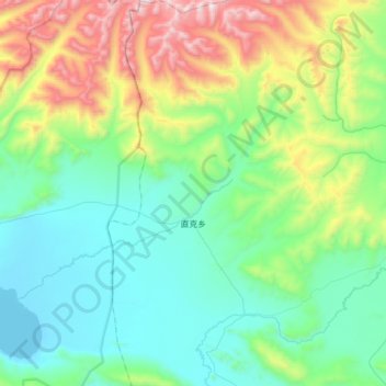
Name: Chig topographic map, elevation, terrain.

Location: Chig, Kampa County, Shigatse Prefecture, Tibet, China (28.34966 88.34141 28.64964 88.55462)

Average elevation: 4,783 m

Minimum elevation: 4,422 m

Maximum elevation: 5,843 m

Other topographic maps

Click on a map to view its topography, its elevation and its terrain.

塞塞拉

China > Tibet > Kampa County

Average elevation: 5,384 m

Gear up for your next adventure:

💡LED Headlamp - Hands-free illumination for night hiking and camping
👟Sport Hiking Sandals - Breathable footwear for water crossings and camp rest
🛌Insulated Sleeping Pad - Critical thermal barrier between you and the cold ground
🧥Waterproof Hiking Jacket - Protect yourself from rain and wind while hiking
🥘Camping Cookware Set - Compact nesting pots and pans for trail cooking

As an Amazon Associate, this site earns from qualifying purchases at no extra cost to you.