
Thank you for supporting this site ❤️
Make a donation
Make a donation
Gear up for your next adventure:
As an Amazon Associate, this site earns from qualifying purchases at no extra cost to you.
Bunree topographic map
Click on the map to display elevation.
Thank you for supporting this site ❤️
Make a donation
Make a donation
Gear up for your next adventure:
As an Amazon Associate, this site earns from qualifying purchases at no extra cost to you.
About this map
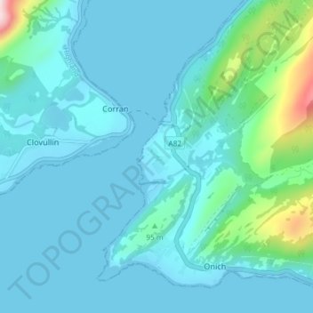
Name: Bunree topographic map, elevation, terrain.
Location: Bunree, Corran, Highland, Écosse, PH33 6SE, Royaume-Uni (56.69710 -5.25640 56.73710 -5.21640)
Average elevation: 53 m
Minimum elevation: 0 m
Maximum elevation: 437 m
Thank you for supporting this site ❤️
Make a donation
Make a donation
Gear up for your next adventure:
As an Amazon Associate, this site earns from qualifying purchases at no extra cost to you.