Geolocate

Kumarakudi topographic map

Click on the map to display elevation.

About this map

Name: Kumarakudi topographic map, elevation, terrain.

Location: Kumarakudi, Manachanallur, Tiruchirappalli, Tamil Nadu, 621216, India (10.87271 78.66570 10.91271 78.70570)

Average elevation: 69 m

Minimum elevation: 63 m

Maximum elevation: 80 m

Other topographic maps

Click on a map to view its topography, its elevation and its terrain.
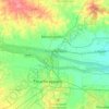
Kollidam River

India > Tamil Nadu > Manachanallur > Vathalai

Average elevation: 79 m

Gear up for your next adventure:

🧴Insect Repellent - Protect yourself from bugs during outdoor adventures
🥾Hiking Boots - Sturdy boots providing ankle support and traction on rugged trails
🏕️Camping Hammock - Integrated protection for sleeping between trees
🥾Approach Boots - Comfortable boots for hiking and climbing approaches
🧤Thermal Hiking Gloves - Grip-enhanced gloves for cold-weather altitude trekking

As an Amazon Associate, this site earns from qualifying purchases at no extra cost to you.