Geolocate

Camantao topographic map

Click on the map to display elevation.

About this map

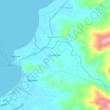
Name: Camantao topographic map, elevation, terrain.

Location: Camantao, Odiongan, Romblon, Mimaropa, 5505, Philippines (12.40056 121.98389 12.44056 122.02389)

Average elevation: 31 m

Minimum elevation: -1 m

Maximum elevation: 193 m

Gear up for your next adventure:

🧼Biodegradable Camp Soap - Environmentally friendly cleaning for gear and body
🏃Hydration Running Vest - Carry water and maps close to your body for speed
🛶Waterproof Dry Bags - Keep electronics and clothes dry during river crossings
🥾Approach Shoes - Shoes designed for climbing approaches and rugged trails
🥾Approach Boots - Comfortable boots for hiking and climbing approaches

As an Amazon Associate, this site earns from qualifying purchases at no extra cost to you.