Geolocate

Smokemont topographic map

Click on the map to display elevation.

About this map

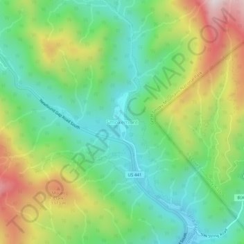
Name: Smokemont topographic map, elevation, terrain.

Location: Smokemont, Swain County, North Carolina, United States (35.53831 -83.33184 35.57831 -83.29184)

Average elevation: 898 m

Minimum elevation: 644 m

Maximum elevation: 1,350 m

Gear up for your next adventure:

🗺️Topographic Maps - Detailed maps to explore trails, mountains, and wilderness areas
🔦LED Headlamp - Hands-free lighting for early morning starts or late finishes
💧Hydration Bladder - Hands-free hydration solution for long treks
🥾Lightweight Hiking Shoes - Comfortable shoes for day hikes
💡LED Camping Lantern - Illuminate your campsite with long-lasting lanterns

As an Amazon Associate, this site earns from qualifying purchases at no extra cost to you.