Geolocate

Arratzain topographic map

Click on the map to display elevation.

About this map

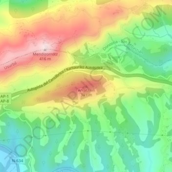
Name: Arratzain topographic map, elevation, terrain.

Location: Arratzain, Usúrbil, Guipúzcoa, País Vasco, 20170, España (43.29207 -2.05811 43.29217 -2.05801)

Average elevation: 165 m

Minimum elevation: -3 m

Maximum elevation: 388 m

Gear up for your next adventure:

🌬️Windproof Camp Stove - Efficient cooking even on exposed mountain peaks
💡LED Headlamp - Hands-free illumination for night hiking and camping
🥾Hiking Shorts - Breathable shorts suitable for summer hikes
🦟Insect Repellent - Keep mosquitoes and black flies away in wooded areas
🩹Compact First Aid Kit - Pre-packed essentials for common trail injuries

As an Amazon Associate, this site earns from qualifying purchases at no extra cost to you.