Geolocate

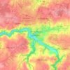
Carnoët topographic map

Click on the map to display elevation.

About this map

Name: Carnoët topographic map, elevation, terrain.

Location: Carnoët, Guingamp, Côtes-d'Armor, Brittany, Metropolitan France, 22160, France (48.31174 -3.60791 48.40227 -3.47688)

Average elevation: 153 m

Minimum elevation: 84 m

Maximum elevation: 233 m

Other topographic maps

Click on a map to view its topography, its elevation and its terrain.
Ploumanac'h

France > Brittany > Côtes-d'Armor

Average elevation: 10 m

Lannion

France > Brittany > Côtes-d'Armor > Lannion > Lannion

Average elevation: 72 m

Penker

France > Brittany > Côtes-d'Armor > Louannec

Average elevation: 44 m

La Croix de Bois

France > Brittany > Côtes-d'Armor > Boqueho

Average elevation: 190 m

La Buglais

France > Brittany > Côtes-d'Armor > Lancieux

Average elevation: 8 m

La Menardais

France > Brittany > Côtes-d'Armor > Taden

Average elevation: 55 m

Pont Auffret

France > Brittany > Côtes-d'Armor > Rostrenen

Average elevation: 196 m

Rumoyec

France > Brittany > Côtes-d'Armor > Plusquellec

Average elevation: 162 m

Gear up for your next adventure:

🧦Hiking Socks - Moisture-wicking and comfortable socks for long hikes
🎒Hiking Daypack - Lightweight and durable backpacks for day trips and excursions
🧢Outdoor Cap - Protective cap for sun and rain during hikes
🧴Bear Spray Holster - Quick-access carry for essential Canadian wilderness safety
🧊Insulated Water Bottle - Keeps drinks cold in summer and prevents freezing in winter

As an Amazon Associate, this site earns from qualifying purchases at no extra cost to you.