Geolocate

Weissach topographic map

Click on the map to display elevation.

About this map

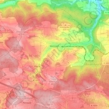
Name: Weissach topographic map, elevation, terrain.

Location: Weissach, Landkreis Böblingen, Baden-Württemberg, 71287, Germany (48.81615 8.87148 48.86765 8.96599)

Average elevation: 421 m

Minimum elevation: 276 m

Maximum elevation: 498 m

Other topographic maps

Click on a map to view its topography, its elevation and its terrain.

Gear up for your next adventure:

🧴Insect Repellent - Protect yourself from bugs during outdoor adventures
🔥Camping Stove - Portable stoves to cook outdoors with ease
🧦Thermal Socks - Warm socks for winter hiking or camping
Lightweight Camping Tent - Portable shelter optimized for Canadian backcountry camping
🪑Insulated Seat Pad - Protect your seat from cold rocks and wet logs

As an Amazon Associate, this site earns from qualifying purchases at no extra cost to you.