Geolocate

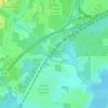
Wheelerville topographic map

Click on the map to display elevation.

About this map

Name: Wheelerville topographic map, elevation, terrain.

Location: Wheelerville, Mobile County Commission District 2, Mobile, Mobile County, Alabama, 36608, United States (30.67019 -88.21167 30.71019 -88.17167)

Average elevation: 57 m

Minimum elevation: 32 m

Maximum elevation: 72 m

Other topographic maps

Click on a map to view its topography, its elevation and its terrain.
Moore Creek

United States > Alabama > Mobile County > Mobile

Average elevation: 8 m

Gear up for your next adventure:

🥾Hiking Shoes - Durable and comfortable shoes for trail hiking
🥾Lightweight Hiking Boots - Boots for comfort and mobility on long hikes
🥾Lightweight Hiking Shoes - Comfortable shoes for day hikes
🧢Hiking Sun Hat - Wide-brimmed protection for exposed mountain ridges
🧢Sun Protection Cap - Breathable cap to protect from sun exposure

As an Amazon Associate, this site earns from qualifying purchases at no extra cost to you.