

Kitale topographic map
Click on the map to display elevation.
Kitale
Kitale is a town in the north west of Kenya, within the county of Trans Nzoia which was formerly in the former Rift Valley province prior to the creation of the 2010 constitution. The town lies between Mount Elgon and the Cherang'any Hills. It has an elevation of around 1900 metres (6200 ft). Its population was 162,174 as of 2019. It is the location of Kitale Airport.
About this map
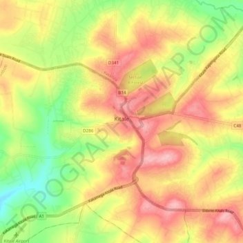
Name: Kitale topographic map, elevation, terrain.
Location: Kitale, Saboti, Trans-Nzoia County, Kenya (0.97808 34.95563 1.05592 35.05091)
Average elevation: 1,849 m
Minimum elevation: 1,770 m
Maximum elevation: 1,915 m