
Beddgelert topographic map
Interactive map
Click on the map to display elevation.
About this map
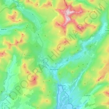
Name: Beddgelert topographic map, elevation, terrain.
Location: Beddgelert, Gwynedd, Pays de Galles, Royaume-Uni (52.96670 -4.16162 53.08971 -3.97685)
Average elevation: 315 m
Minimum elevation: 1 m
Maximum elevation: 1,061 m